Software and satellite support for NASA document changes in the world's oceans
High above the Earth, instruments on four NASA satellites collect data that reveal the amount of plant life in the sea below. Scientists who study the ocean's health depend on us to accurately process and distribute that data.
Based at Goddard Space Flight Center, our team works collaboratively with NASA scientists and team member Science Systems and Applications, Inc. (SSAI) to support NASA's Ocean Color program. We develop software, perform data analysis, and monitor the satellite instruments that take visible light images the agency uses to document changes in the color of the ocean.
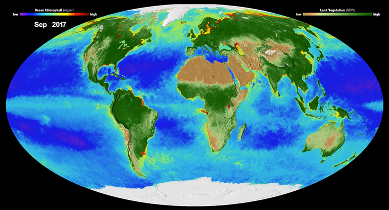
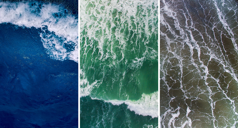
Changes from blue to various shades of green reflect the concentration of phytoplankton, which are microscopic plants at the bottom of the food chain and the driving force for all ocean life. Like plants on the Earth's surface, they absorb carbon dioxide through photosynthesis and convert it into oxygen.
"The air that we breathe really depends upon the biological health of the ocean," said Fred Patt, who manages our work for NASA.
Satellite data is powerful because it allows scientists to see the entire world," Patt added. "We can monitor global effects and changes in ocean biology, and we can do it literally every day."
Software unpacks data from satellites
Our team develops software and algorithms that convert the raw data streaming from the satellites into images. It's a multi-step process made more difficult by atmospheric corrections. Since the satellite sees sunlight scattered off the atmosphere, brightness needs to be removed in order to see the ocean's surface.
We also have developed software models that infer how much chlorophyll is in the water and estimate the amount of phytoplankton. All images and data are available on a NASA website that research scientists and the public can access.
Aside from software developers, our team includes data analysts as well as systems administrators and managers who operate and maintain the program's computer systems.
Instruments run smoothly
As part of our work on the program, we support four NASA satellite missions that collect the data that we then manage. Before each mission launched, our team evaluated the design of the instruments and helped test them.
Now we monitor the instruments to ensure that they're running smoothly. Two missions have been in operation for more than 15 years; together, they view the entire Earth's surface every one to two days.
Research scientists rely on satellite data
Oceanographers use the images we process to understand how the biology of the ocean changes over the short and long term. These scientists work at universities and other organizations, including:
- Scripps Research Institute in California
- Woods Hole Oceanographic Institution in Massachusetts
- Naval Research Laboratory in Washington, D.C., and Mississippi
- National Oceanographic and Atmospheric Association
For example, satellite images show the ocean turning green in the North Atlantic during the spring as the sun moves farther north and phytoplankton populations explode. These blooms are a smorgasbord for fish and ultimately benefit humans and the fishing industry in New England.
But intense chlorophyll concentrations can be dangerous, like the large algal blooms in Florida that produce toxins and harm sea life as well as people. Now scientists are developing algorithms that use our data to better predict these blooms.
Scientists also use the satellite data we collect and process to monitor climate change. In fact, a key area of research is how variations in phytoplankton concentration and population affect the rate of carbon capture.
Learn more about our engineering solutions >


